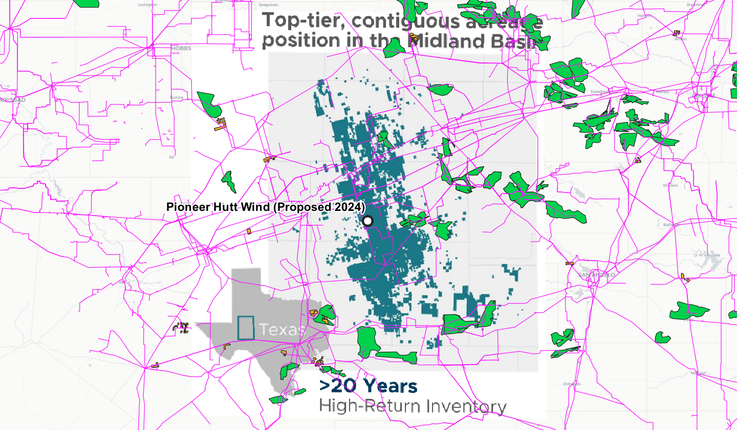
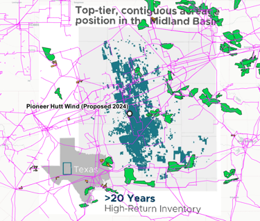
Georeferencing Pioneer's oil & gas acreage against Nextera's wind farm in Midland County
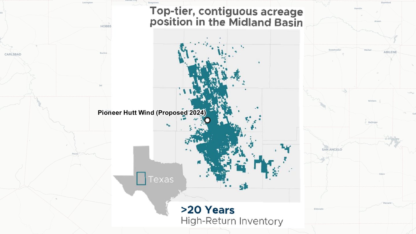
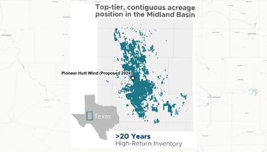
Used QGIS's georeferencing functionality to align Pioneer Natural Resources' oil & gas acreage with Nextera Energy's planned 140 MW wind farm.
Independently sourced the Hutt Ranch location where the wind farm will be located in the future. The project is expected to be operational in 2024.
This project marks a significant step forward in the energy transition as it sets an example for oil & gas companies to partner with renewable energy developers like Nextera Energy to reduce their carbon footprint.
Overlaid existing wind power projects and infrastructure from OpenInfra on top of PXD's acreage (below).
Undertook this project purely for fun and due to a passion for geospatial analysis and the decarbonization of the energy industry.